
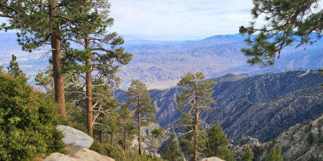
Palm Springs is a hiker’s paradise, offering a variety of trails that showcase the region’s unique desert landscapes, lush oases, and panoramic mountain vistas. PalmSprings.com was the first online source for hiking trails back in 1995. Here are five of the best hiking trails in and around Palm Springs, complete with their locations and a map to help you plan your adventure.
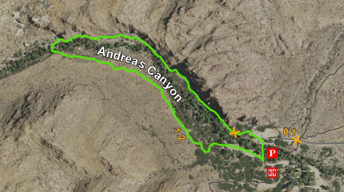
1. Andreas Canyon Trail
- Andreas Canyon is considered the world’s second largest California Fan Palm oasis
- Location: Indian Canyons, south of downtown Palm Springs
- Distance: 1 mile loop
- Difficulty: Easy
- The trail starts at the rail Information Board located just north of the bridge
- Highlights: This short trail offers a lush oasis with a perennial stream, towering palm trees, and striking rock formations. It’s part of the Agua Caliente Band of Cahuilla Indians reservation.
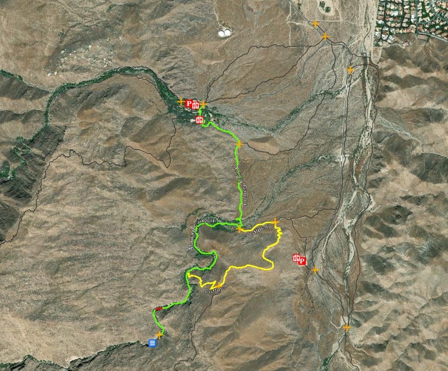
2. Murray Canyon Trail to Seven Falls
- Location: Indian Canyons
- Distance: 3.7 miles out-and-back
- Difficulty: Moderate
- The trail starts at the south end of the Andreas Canyon Trailhead/ South Palm Canyon Drive parking lot
- Highlights: This trail leads hikers through a scenic canyon to the Seven Sisters Waterfall, offering opportunities to spot wildlife like bighorn sheep.
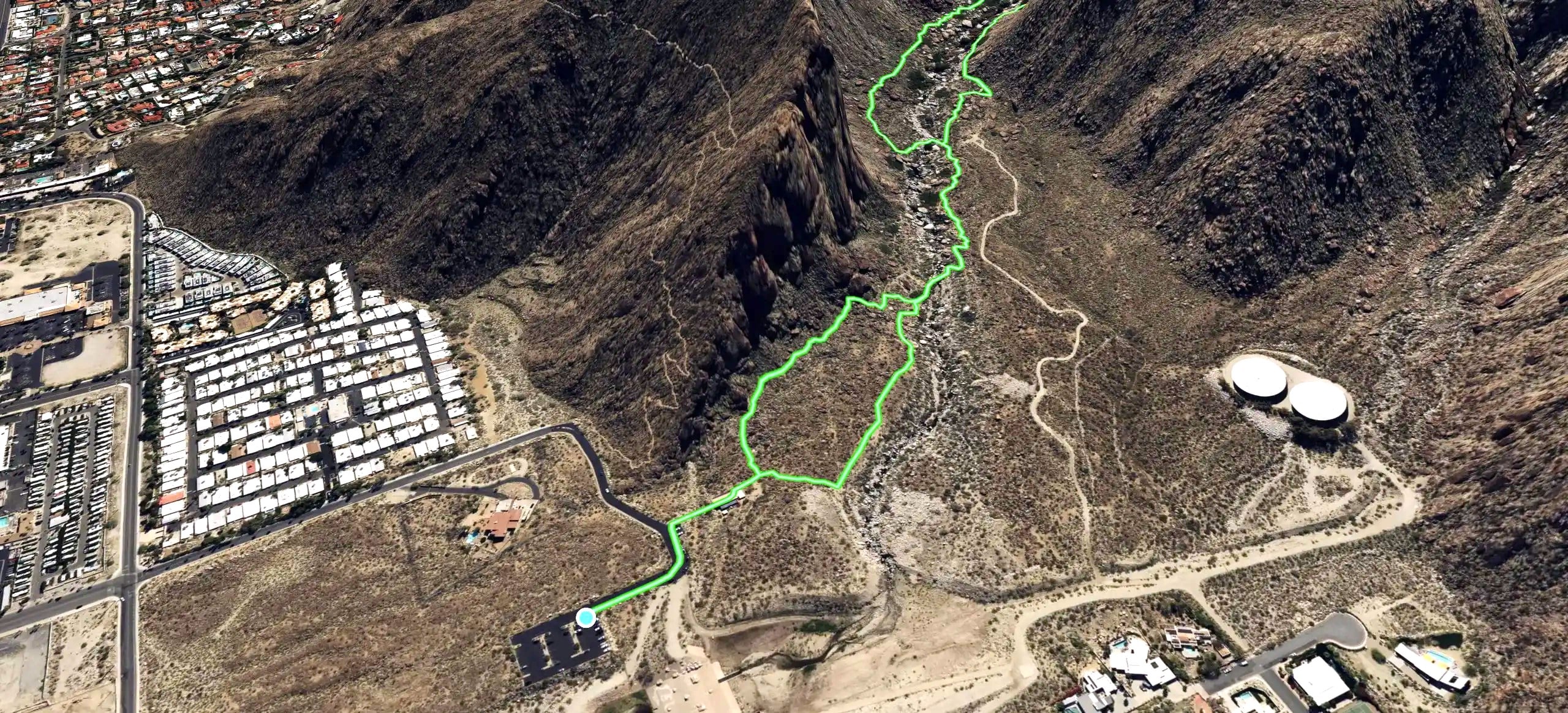
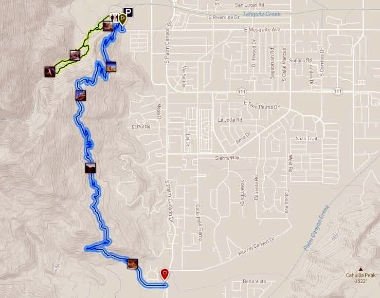
3. Tahquitz Canyon Loop Trail
- Location: Tahquitz Canyon, west of downtown Palm Springs
- Distance: 1.7 miles loop
- Difficulty: Moderate
- Trail starts at the Tahquitz Visitor Center, located at 500 W Mesquite Ave in Palm Springs
- Highlights: This trail features a 60-foot waterfall, ancient rock art, and is rich in Native American history. It’s managed by the Agua Caliente Band of Cahuilla Indians.
4. South Lykken Trail
- Location: Trailheads at South Palm Canyon Drive and Mesquite Avenue
- Distance: Up to 7.3 miles round-trip
- Difficulty: Moderate
- Trail starts at the end of Mesquite Road in Palm Springs, where it intersects with Palm Canyon Drive
- Highlights: Offering panoramic views of Palm Springs and the Coachella Valley, this trail is popular for sunrise and sunset hikes.
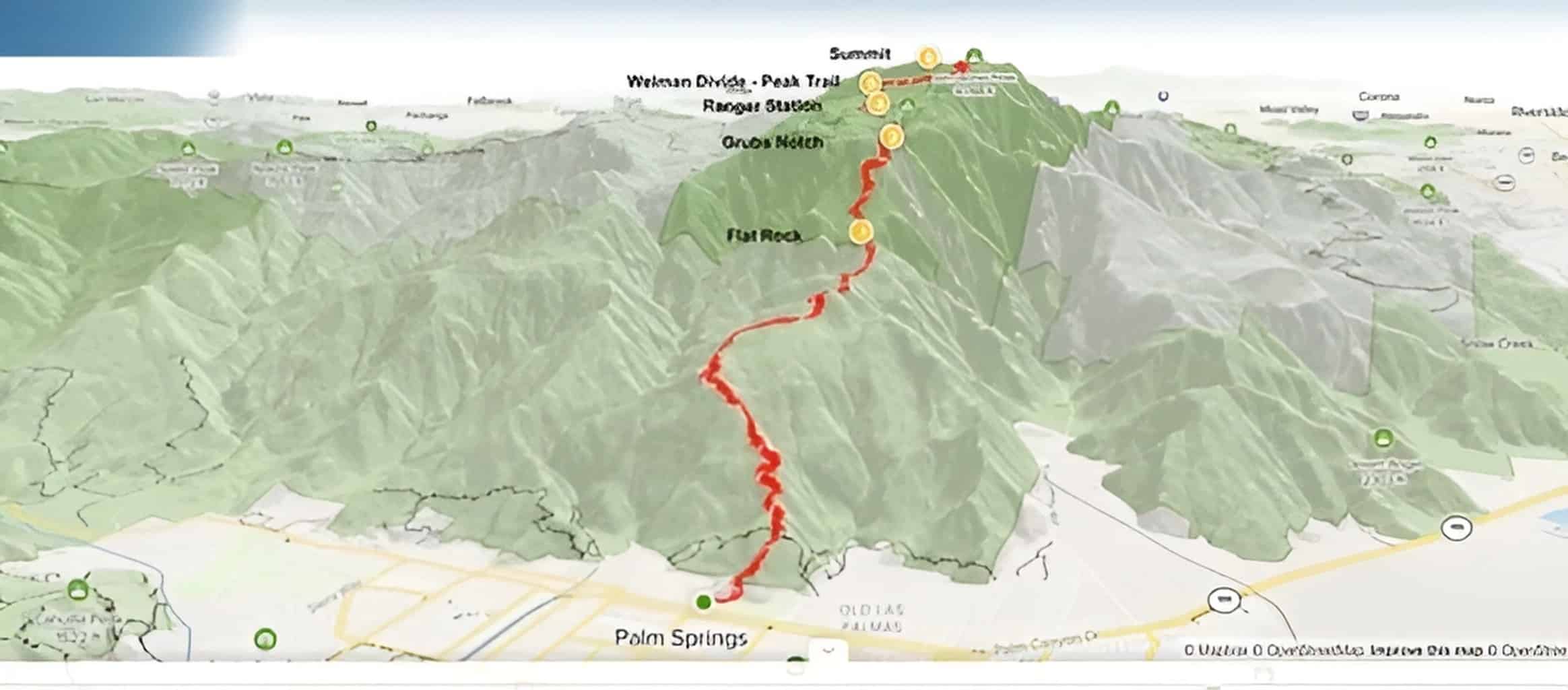
5. Cactus to Clouds Trail (Skyline Trail)
- Location: Starts behind the Palm Springs Art Museum
- Distance: Approximately 21 miles to San Jacinto Peak
- Difficulty: Very Strenuous
- The best times to visit this trail are October through July.
- The trail begins just north of the Palm Springs Art Museum, about six and a half miles from the base of the tram.
- Highlights: Known for its extreme elevation gain of over 10,000 feet, this trail is one of the most challenging day hikes in the U.S., culminating at the summit of San Jacinto Peak. Check heat index conditions before engaging in this activity.
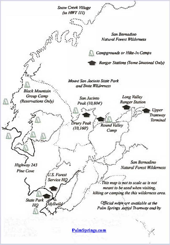
Map of Palm Springs Aerial Tramway Trails
Tips for Hiking in Palm Springs:
- Stay Hydrated: Carry plenty of water, especially during warmer months.
- Start Early: Begin hikes early in the day to avoid peak heat.
- Wear Appropriate Gear: Use sturdy hiking shoes and sun protection.
- Check Trail Conditions: Some trails may have fees or restrictions; verify before heading out.
- Respect Nature: Stay on designated trails and pack out all trash.
Enjoy your hiking adventures in Palm Springs!